Accomplishments
MetroGIS has made significant progress towards fulfilling its original vision, thanks to substantial financial and resource commitments made by the Metropolitan Council, several hundred volunteers representing dozens of cooperating organizations, and grants received from the National Spatial Data Infrastructure (NSDI) program.
Awards
State Government Innovation (SGI) Award, 2014

MetroGIS received a ‘State Government Innovation Award’ in August 2014 from the Humphrey School of Public Affairs (University of Minnesota) and Bush Foundation for the ‘Free and Open Public Geospatial Data Initiative’ which it began in 2013 and brought to fruition in 2014. The initiative resulted in policy changes leading to more government geospatial data being readily available, and paved the way for better ability for governments to provide efficient public service and cost savings.
Exemplary Systems in Government (ESIG) Award, 2002

MetroGIS received the ESIG Award in 2002 from URISA. A quote from the awarding panel of judges about MetroGIS:
"The system is an ambitious project and one that is still evolving. It has brought many units of regional and local governments together in order to create a comprehensive geodata system and a collaborative environment for its members to communicate and benefit from one another. These efforts, and the wealth of datasets and ease of access from a web-based interface, make the system an exemplary one that others can learn from and replicate. The system is exemplary because it provides a one-stop clearinghouse for a variety of data that citizens, companies and public agencies can use”
Planning Merit Award for an Outstanding Planning Tool, 2002
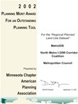
MnAPA awarded the Planning Merit Award to Metropolitan Council, MetroGIS and the I-35W Corridor Coalition for their participation in developing the Twin Cities Regional Planned Land Use Dataset. MnAPA recognized the relevance of this dataset and its importance to the planning community as a whole within the Twin Cities Metropolitan Area. The special award also represents an acknowledgement of the importance Geographic Information Systems (GIS) and other information technologies are having on the community planning process and how successful collaborative efforts among communities and organizations can lead to relevant and extremely useful data solutions.
Geography Network Challenge: Grand Prize Winner, 2001

MetroGIS was the winner of the inaugural Geography Network Challenge for its DataFinder and its web service resources. The contest, sponsored by ESRI and the National Geographic Society, was started to increase the awareness of Internet mapping services and recognize innovative Internet mapping applications. MetroGIS awarded $5000 in training for ESRI software and made this training award available to all MetroGIS stakeholder organizations; 63 courses were completed by 59 individuals.
Cooperative Public Service Award: Certificate of Commendation, 2000

Partnership Minnesota was formed in 1988 to promote enhanced cooperation among federal, state and local agencies for the purpose of providing better service to the citizens of Minnesota. Partnership Minnesota acknowledged the work of the Metropolitan Council, MetroGIS and the Minnesota Department of Natural Resources for developing the Minnesota Land Cover Classification System (MLCCS)
Exemplary GIS Project: Certificate of Commendation, 1998

On October 9, 1998 at the Minnesota GIS/LIS Consortium Conference in St. Cloud, the Metropolitan Council, Minnesota Department of Transportation, and The Lawrence Group (NCompass) received an Exemplary GIS Project Commendation from the Governor for their contributions to promoting the principles of MetroGIS by way of the MetroGIS Regional Street Centerline Dataset Project. Through this project, government and academic institutions serving the State have free use of the street centerline dataset owned by The Lawrence Group (NCompass). MetroGIS distributes the data through the Metropolitan Council's FTP site.
View the Nomination Letter
View the Certificate of Commendation
Key Accomplishments
-
The development and strengthening of relationships between governments using geospatial technology
- Changing established government policy from sale and licensure of geospatial data to free and open access
- Raising the awareness of the importance of geospatial technology to elected officials and decision makers
- Deployment and maintenance of the DataFinder geospatial data clearinghouse as a registered node of the NSDI
- Co-implementation of the GeoService Finder with MnGeo
- Creation of endorsed standards for FGDC-compliant metadata, a regional projection and coordinate system and data content standards
- Executed agreements that provide access by all government interests serving the seven county area, without fee and subject to identical access requirements, to parcel and other geospatial data produced by all seven metro area counties and the Metropolitan Council
- Provided testimony before a United States House of Representatives Subcommittee in conjunction with the 1999 National GeoData Forum